
Talbot County topographic map
Interactive map
Click on the map to display elevation.
About this map
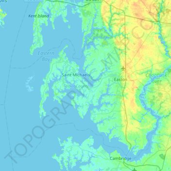
Name: Talbot County topographic map, elevation, terrain.
Location: Talbot County, Maryland, United States (38.57057 -76.45985 38.94503 -75.89596)
Average elevation: 5 m
Minimum elevation: -3 m
Maximum elevation: 33 m
Other topographic maps
Click on a map to view its topography, its elevation and its terrain.
Easton Primary Sewage Lagoon Dam
United States > Maryland > Talbot County
Easton Primary Sewage Lagoon Dam, Talbot County, Maryland, United States
Average elevation: 9 m