
Cantabrian Mountains topographic map
Interactive map
Click on the map to display elevation.
About this map
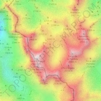
Name: Cantabrian Mountains topographic map, elevation, terrain.
Location: Cantabrian Mountains, Cabrales, Asturias, Spain (43.20006 -4.84787 43.20016 -4.84777)
Average elevation: 2,211 m
Minimum elevation: 1,733 m
Maximum elevation: 2,625 m
Other topographic maps
Click on a map to view its topography, its elevation and its terrain.