
Clarinda topographic map
Interactive map
Click on the map to display elevation.
About this map
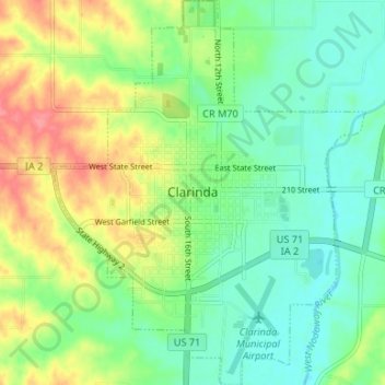
Name: Clarinda topographic map, elevation, terrain.
Location: Clarinda, Page County, Iowa, 51632, United States (40.71365 -95.06118 40.76396 -95.00726)
Average elevation: 318 m
Minimum elevation: 291 m
Maximum elevation: 363 m
Other topographic maps
Click on a map to view its topography, its elevation and its terrain.
Hepburn
United States > Iowa > Page County
Hepburn, Page County, Iowa, United States
Average elevation: 328 m