
Songhua River topographic map
Interactive map
Click on the map to display elevation.
About this map
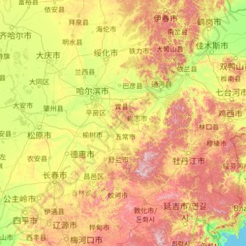
Name: Songhua River topographic map, elevation, terrain.
Average elevation: 310 m
Minimum elevation: 0 m
Maximum elevation: 1,678 m
Other topographic maps
Click on a map to view its topography, its elevation and its terrain.
Fangzheng
PRC > Heilongjiang > Harbin City
Fangzheng, Harbin City, Heilongjiang, PRC
Average elevation: 301 m