
Korweinguboora topographic map
Interactive map
Click on the map to display elevation.
About this map
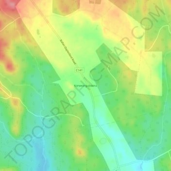
Name: Korweinguboora topographic map, elevation, terrain.
Average elevation: 636 m
Minimum elevation: 593 m
Maximum elevation: 694 m
Other topographic maps
Click on a map to view its topography, its elevation and its terrain.
Korweinguboora
Australia > Victoria > Korweinguboora
Korweinguboora, Shire of Moorabool, Victoria, Australia
Average elevation: 675 m