
Galleh Kuh-e topographic map
Interactive map
Click on the map to display elevation.
About this map
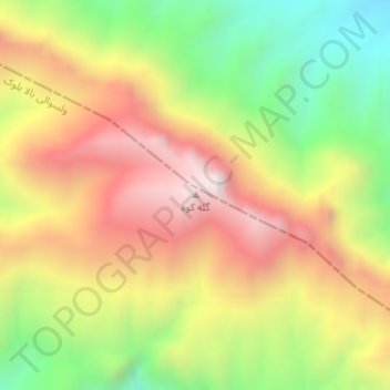
Name: Galleh Kuh-e topographic map, elevation, terrain.
Location: Galleh Kuh-e, Bala Buluk, Farah, Afghanistan (33.11725 63.15868 33.11735 63.15878)
Average elevation: 2,017 m
Minimum elevation: 1,530 m
Maximum elevation: 2,489 m