
Lynnwood topographic map
Interactive map
Click on the map to display elevation.
About this map
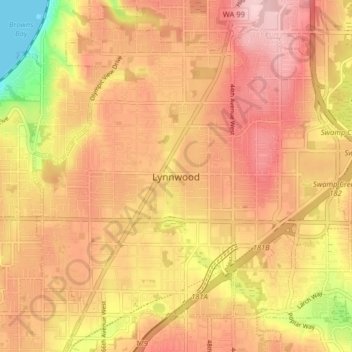
Name: Lynnwood topographic map, elevation, terrain.
Location: Lynnwood, Snohomish County, Washington, United States (47.80203 -122.34183 47.85388 -122.26181)
Average elevation: 121 m
Minimum elevation: 0 m
Maximum elevation: 190 m
Other topographic maps
Click on a map to view its topography, its elevation and its terrain.