
Hamilton Hill topographic map
Interactive map
Click on the map to display elevation.
About this map
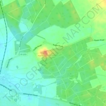
Name: Hamilton Hill topographic map, elevation, terrain.
Average elevation: 36 m
Minimum elevation: 23 m
Maximum elevation: 60 m
Other topographic maps
Click on a map to view its topography, its elevation and its terrain.
West Lindsey
United Kingdom > England > West Lindsey
West Lindsey, Lincolnshire, East Midlands, England, United Kingdom
Average elevation: 30 m
Scothern CP
United Kingdom > England > West Lindsey
Scothern CP, West Lindsey, Lincolnshire, East Midlands, England, United Kingdom
Average elevation: 21 m