
Sandnes topographic map
Interactive map
Click on the map to display elevation.
About this map
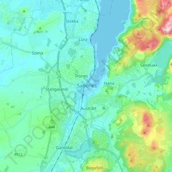
Name: Sandnes topographic map, elevation, terrain.
Location: Sandnes, Rogaland, 4304, Norway (58.81178 5.69699 58.89178 5.77699)
Average elevation: 61 m
Minimum elevation: 0 m
Maximum elevation: 333 m
Other topographic maps
Click on a map to view its topography, its elevation and its terrain.