
Pedra Bela topographic map
Interactive map
Click on the map to display elevation.
About this map
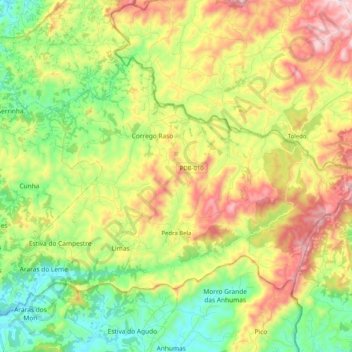
Name: Pedra Bela topographic map, elevation, terrain.
Average elevation: 1,076 m
Minimum elevation: 806 m
Maximum elevation: 1,470 m
Pedra Bela is a municipality in the state of São Paulo in Brazil. The population is 6,044 (2015 est.) in an area of 159 km². The elevation is 1,120 m.