
Pelion topographic map
Interactive map
Click on the map to display elevation.
About this map
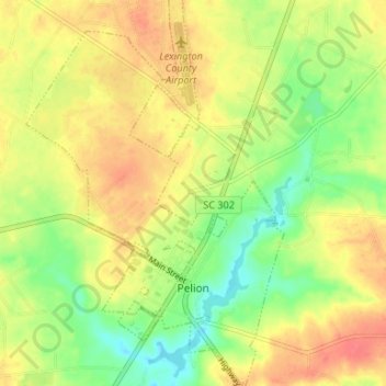
Name: Pelion topographic map, elevation, terrain.
Location: Pelion, Lexington County, South Carolina, 29123, USA (33.74870 -81.27354 33.80364 -81.22892)
Average elevation: 127 m
Minimum elevation: 98 m
Maximum elevation: 152 m