
Gemeinde Nassereith topographic map
Interactive map
Click on the map to display elevation.
About this map
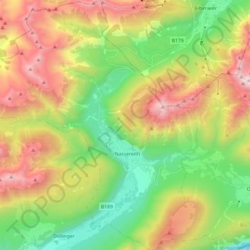
Name: Gemeinde Nassereith topographic map, elevation, terrain.
Location: Gemeinde Nassereith, Bezirk Imst, Tyrol, 6465, Austria (47.27020 10.72332 47.38587 10.88633)
Average elevation: 1,474 m
Minimum elevation: 648 m
Maximum elevation: 2,652 m
Other topographic maps
Click on a map to view its topography, its elevation and its terrain.
Stadt Imst
Austria > Tyrol > Bezirk Imst > Stadt Imst
Stadt Imst, Bezirk Imst, Tyrol, 6460, Austria
Average elevation: 1,613 m