
Raleigh topographic map
Interactive map
Click on the map to display elevation.
About this map
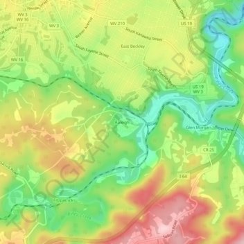
Name: Raleigh topographic map, elevation, terrain.
Location: Raleigh, Raleigh County, West Virginia, 25911, United States (37.73678 -81.19427 37.77678 -81.15427)
Average elevation: 715 m
Minimum elevation: 608 m
Maximum elevation: 833 m
Other topographic maps
Click on a map to view its topography, its elevation and its terrain.
Mountview
United States > West Virginia > Raleigh County > Mountview
Mountview, Raleigh County, West Virginia, 25825, United States
Average elevation: 893 m
Lego
United States > West Virginia > Raleigh County > Lego
Lego, Raleigh County, West Virginia, 25857, United States
Average elevation: 700 m