
Nordre Follo topographic map
Interactive map
Click on the map to display elevation.
About this map
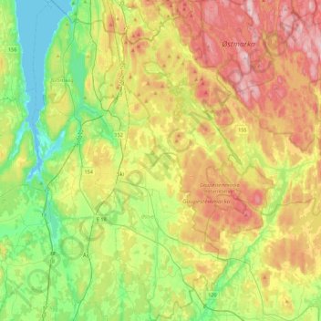
Name: Nordre Follo topographic map, elevation, terrain.
Location: Nordre Follo, Viken, Norway (59.61868 10.71864 59.83928 10.99198)
Average elevation: 142 m
Minimum elevation: 0 m
Maximum elevation: 349 m
Other topographic maps
Click on a map to view its topography, its elevation and its terrain.