
Town of Perry topographic map
Interactive map
Click on the map to display elevation.
About this map
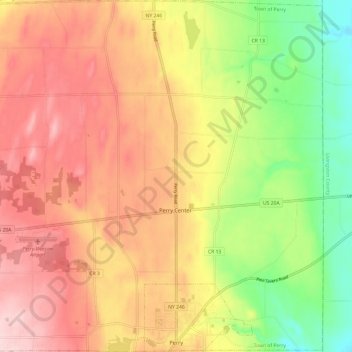
Name: Town of Perry topographic map, elevation, terrain.
Average elevation: 403 m
Minimum elevation: 280 m
Maximum elevation: 505 m
Other topographic maps
Click on a map to view its topography, its elevation and its terrain.
Village of Perry
United States > New York > Wyoming County
Village of Perry, Town of Perry, Wyoming County, New York, 14530, United States
Average elevation: 414 m
Wheelers Hill
United States > New York > Wyoming County
Wheelers Hill, Town of Middlebury, Wyoming County, New York, 14039, United States
Average elevation: 458 m