
Kawah Ijen topographic map
Interactive map
Click on the map to display elevation.
About this map
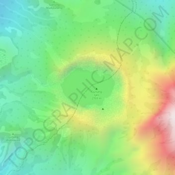
Name: Kawah Ijen topographic map, elevation, terrain.
Location: Kawah Ijen, Blue Fire trek, Kalipuro, Jatim, Indonesia (-8.06181 114.23771 -8.05449 114.24591)
Average elevation: 2,175 m
Minimum elevation: 1,817 m
Maximum elevation: 2,743 m