Geolocate

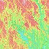
Lekvattnet topographic map

Click on the map to display elevation.

About this map

Name: Lekvattnet topographic map, elevation, terrain.

Location: Lekvattnet, Lekvattnet distrikt, Torsby kommun, Värmland County, Sweden (60.16932 12.65656 60.20932 12.69656)

Average elevation: 290 m

Minimum elevation: 194 m

Maximum elevation: 451 m

Other topographic maps

Click on a map to view its topography, its elevation and its terrain.

Årjängs kommun

Sweden > Värmland County

Average elevation: 168 m

Hammarö kommun

Sweden > Värmland County

Average elevation: 45 m

Arvika kommun

Sweden > Värmland County

Average elevation: 182 m

Glaskogen

Sweden > Värmland County

Average elevation: 194 m

Torsby kommun

Sweden > Värmland County

Average elevation: 356 m

Hammarö kommun

Sweden > Värmland County

Average elevation: 45 m

Säffle kommun

Sweden > Värmland County

Average elevation: 89 m

Kils kommun

Sweden > Värmland County

Average elevation: 104 m

Hagfors kommun

Sweden > Värmland County

Average elevation: 257 m

Filipstads kommun

Sweden > Värmland County

Average elevation: 241 m

Hammarö kommun

Sweden > Värmland County

Average elevation: 45 m

Storfors kommun

Sweden > Värmland County

Average elevation: 158 m

Pottern

Sweden > Värmland County

Average elevation: 145 m

Karlstads kommun

Sweden > Värmland County

Average elevation: 109 m

Sunne kommun

Sweden > Värmland County

Average elevation: 194 m

Gear up for your next adventure:

📸Action Cameras - Record your journey across interesting topographic features in 4K
🩹First Aid Kits - Emergency kits for hiking
🗺️Topographic Maps - Detailed maps for hiking and navigation
☕Outdoor Coffee Makers - Enjoy quality coffee at the summit of your favorite peak
🔋Rechargeable Batteries - Eco-friendly power for high-drain GPS units and flashlights

As an Amazon Associate, this site earns from qualifying purchases at no extra cost to you.