
Kotamobagu topographic map
Interactive map
Click on the map to display elevation.
About this map
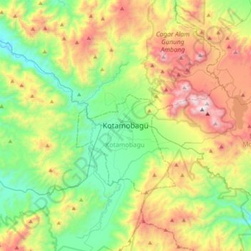
Name: Kotamobagu topographic map, elevation, terrain.
Location: Kotamobagu, North Sulawesi, 95711, Indonesia (0.57522 124.15541 0.89522 124.47541)
Average elevation: 643 m
Minimum elevation: 24 m
Maximum elevation: 1,757 m