

Meridian Peak topographic map
Click on the map to display elevation.
Meridian Peak
Meridian Peak can be found at the southern end of Elliot Ridge Trail. It can be reached by ascending several hiking trails into the Gore Range. Surprise Lake Trail goes south for 2.6 miles to Surprise Lake, then the Gore Range Trail continues west for 1.9 miles to a junction with the Upper Cataract Lake and Mirror Lake Trail. Mirror Lake is 6.5 miles beyond the junction, at an elevation of 10,560 feet. The Elliot Ridge Trail is 3.2 miles from Mirror Lake. The summit of Meridian Peak is another 1.2 south from the junction with the Elliot Ridge Trail.
About this map
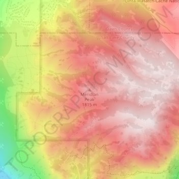
Name: Meridian Peak topographic map, elevation, terrain.
Average elevation: 1,698 m
Minimum elevation: 1,295 m
Maximum elevation: 1,884 m
Other topographic maps
Click on a map to view its topography, its elevation and its terrain.
Jordan River OHV/ Modelport State Park
United States > Utah > Salt Lake County > Salt Lake City
Average elevation: 1,286 m