
Steenwijkerland topographic map
Interactive map
Click on the map to display elevation.
About this map
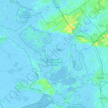
Name: Steenwijkerland topographic map, elevation, terrain.
Location: Steenwijkerland, Overijssel, Pays-Bas (52.64136 5.79518 52.85422 6.20173)
Average elevation: 1 m
Minimum elevation: -5 m
Maximum elevation: 21 m