Geolocate

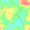
Alvorada topographic map

Click on the map to display elevation.

About this map

Name: Alvorada topographic map, elevation, terrain.

Location: Alvorada, Região Geográfica Imediata de Gurupi, Região Geográfica Intermediária de Gurupi, Tocantins, North Region, 77480-000, Brazil (-12.64200 -49.33611 -12.17500 -48.90250)

Average elevation: 268 m

Minimum elevation: 209 m

Maximum elevation: 423 m

Other topographic maps

Click on a map to view its topography, its elevation and its terrain.

Praia do Segredo

Brazil > Tocantins > Lajeado

Average elevation: 209 m

Campina Verde

Brazil > Tocantins

Average elevation: 271 m

Gear up for your next adventure:

🥾Hiking Shoes - Lightweight hiking shoes for day hikes
🦟Insect Repellent - Protection against insects
🧦Merino Wool Hiking Socks - Moisture-wicking socks to prevent blisters during long topographic surveys
🔪Multitools - Compact tools for outdoor use
🔦Powerful LED Headlamps - Hands-free lighting for night navigation and setting up camp after dark

As an Amazon Associate, this site earns from qualifying purchases at no extra cost to you.