
Bulls Island topographic map
Interactive map
Click on the map to display elevation.
About this map
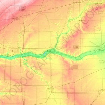
Name: Bulls Island topographic map, elevation, terrain.
Location: Bulls Island, Ottawa, LaSalle County, Illinois, 61350, USA (41.02087 -89.14063 41.66087 -88.50063)
Average elevation: 202 m
Minimum elevation: 117 m
Maximum elevation: 290 m