
Rorschach topographic map
Interactive map
Click on the map to display elevation.
About this map
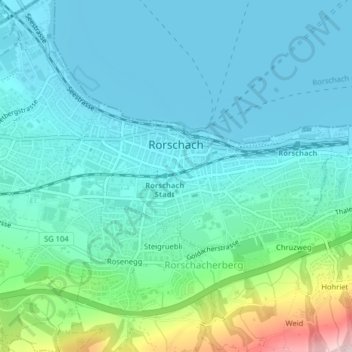
Name: Rorschach topographic map, elevation, terrain.
Location: Rorschach, Wahlkreis Rorschach, Sankt Gallen, 9400, Schweiz (47.46991 9.47892 47.48122 9.51135)
Average elevation: 452 m
Minimum elevation: 392 m
Maximum elevation: 714 m
In Rorschach sind folgende Höhere Schulen ansässig:
Other topographic maps
Click on a map to view its topography, its elevation and its terrain.
Rütli
Schweiz > Sankt Gallen > Wahlkreis Rorschach > Berg (SG)
Rütli, Berg (SG), Wahlkreis Rorschach, Sankt Gallen, 9305, Schweiz
Average elevation: 514 m