
Cann River topographic map
Interactive map
Click on the map to display elevation.
About this map
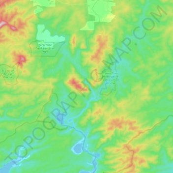
Name: Cann River topographic map, elevation, terrain.
Location: Cann River, Shire of East Gippsland, Victoria, Australia (-37.74144 149.10377 -37.57076 149.14377)
Average elevation: 99 m
Minimum elevation: -5 m
Maximum elevation: 336 m
Other topographic maps
Click on a map to view its topography, its elevation and its terrain.
Cann River
Australia > Victoria > Cann River
Cann River, Shire of East Gippsland, Victoria, 3890, Australia
Average elevation: 385 m
Cann River
Australia > Victoria > Cann River
Cann River, Shire of East Gippsland, Victoria, 3890, Australia
Average elevation: 106 m