
Rotherslade topographic map
Interactive map
Click on the map to display elevation.
About this map
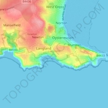
Name: Rotherslade topographic map, elevation, terrain.
Location: Rotherslade, Swansea, Wales, SA3 4QY, United Kingdom (51.54896 -4.02654 51.58896 -3.98654)
Average elevation: 23 m
Minimum elevation: 0 m
Maximum elevation: 101 m