
Thank you for supporting this site ❤️
Make a donation
Make a donation
Gear up for your next adventure:
As an Amazon Associate, this site earns from qualifying purchases at no extra cost to you.
Bougouni topographic map
Click on the map to display elevation.
Thank you for supporting this site ❤️
Make a donation
Make a donation
Gear up for your next adventure:
As an Amazon Associate, this site earns from qualifying purchases at no extra cost to you.
About this map
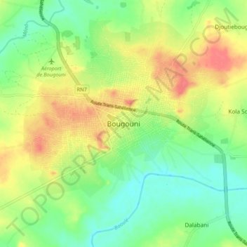
Name: Bougouni topographic map, elevation, terrain.
Location: Bougouni, Bougouni Cercle, Sikasso Region, Mali (11.25943 -7.64339 11.57943 -7.32339)
Average elevation: 345 m
Minimum elevation: 312 m
Maximum elevation: 386 m
Thank you for supporting this site ❤️
Make a donation
Make a donation
Gear up for your next adventure:
As an Amazon Associate, this site earns from qualifying purchases at no extra cost to you.