
Nightcliff topographic map
Interactive map
Click on the map to display elevation.
About this map
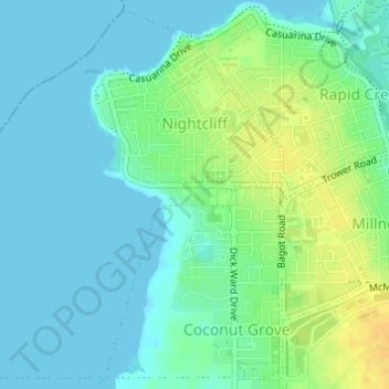
Name: Nightcliff topographic map, elevation, terrain.
Location: Nightcliff, City of Darwin, Northern Territory, Australia (-12.40266 130.82562 -12.37445 130.85602)
Average elevation: 9 m
Minimum elevation: 0 m
Maximum elevation: 28 m
City of Darwin trails, hiking, mountain biking, running and outdoor activities
Other topographic maps
Click on a map to view its topography, its elevation and its terrain.