Geolocate

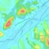
Bateas topographic map

Click on the map to display elevation.

About this map

Name: Bateas topographic map, elevation, terrain.

Location: Bateas, Brusque, Região Geográfica Imediata de Brusque, Região Geográfica Intermediária de Blumenau, Santa Catarina, Região Sul, Brasil (-27.07300 -48.93500 -27.01900 -48.86935)

Average elevation: 132 m

Minimum elevation: 8 m

Maximum elevation: 636 m

Other topographic maps

Click on a map to view its topography, its elevation and its terrain.
Rio Itajaí-Mirim

Brasil > Santa Catarina > Brusque

Average elevation: 29 m

Gear up for your next adventure:

🔥Windproof Plasma Lighters - USB rechargeable lighters that work in high-altitude winds
🎒Ultralight Backpacks - Lightweight packs for long hikes
🩹First Aid Kits - Emergency kits for hiking
🏃Compression Recovery Socks - Reduce leg fatigue after heavy days of elevation gain
🔥Camping Stoves - Portable stoves for outdoor cooking

As an Amazon Associate, this site earns from qualifying purchases at no extra cost to you.