
Samagau topographic map
Interactive map
Click on the map to display elevation.
About this map
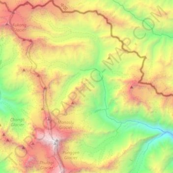
Name: Samagau topographic map, elevation, terrain.
Location: Samagau, Chum Nubri, Gorkha, Gandaki Pradesh, Nepal (28.50762 84.48235 28.75157 84.70470)
Average elevation: 4,966 m
Minimum elevation: 2,842 m
Maximum elevation: 8,035 m
Other topographic maps
Click on a map to view its topography, its elevation and its terrain.