
Thank you for supporting this site ❤️
Make a donation
Make a donation
Gear up for your next adventure:
As an Amazon Associate, this site earns from qualifying purchases at no extra cost to you.
Villamartín topographic map
Click on the map to display elevation.
Thank you for supporting this site ❤️
Make a donation
Make a donation
Gear up for your next adventure:
As an Amazon Associate, this site earns from qualifying purchases at no extra cost to you.
About this map
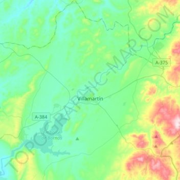
Name: Villamartín topographic map, elevation, terrain.
Location: Villamartín, Sierra de Cádiz, Cádiz, Andalusia, 11650, Spain (36.76261 -5.73631 36.97599 -5.52320)
Average elevation: 189 m
Minimum elevation: 61 m
Maximum elevation: 625 m
Thank you for supporting this site ❤️
Make a donation
Make a donation
Gear up for your next adventure:
As an Amazon Associate, this site earns from qualifying purchases at no extra cost to you.