
Make a donation
Gear up for your next adventure:
As an Amazon Associate, this site earns from qualifying purchases at no extra cost to you.
Uvarsad topographic map
Click on the map to display elevation.
Make a donation
Gear up for your next adventure:
As an Amazon Associate, this site earns from qualifying purchases at no extra cost to you.
About this map
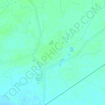
Name: Uvarsad topographic map, elevation, terrain.
Average elevation: 72 m
Minimum elevation: 67 m
Maximum elevation: 76 m
Make a donation
Gear up for your next adventure:
As an Amazon Associate, this site earns from qualifying purchases at no extra cost to you.
Other topographic maps
Click on a map to view its topography, its elevation and its terrain.
Gandhinagar
India > Gujarat > Gandhinagar Taluka > Gandhinagar
Gandhinagar has an average elevation of 81 metres (266 feet). The city sits on the banks of the Sabarmati River, in north-central-east Gujarat. The 20,543 km2 area around Gandhinagar is defined by Gujarat capital territory. It spans an area of 205 km2 (79 sq mi). The river frequently dries up in the summer,…
Average elevation: 76 m
Adalaj
India > Gujarat > Gandhinagar Taluka
Adalaj is located at 23°10′N 72°35′E / 23.17°N 72.58°E / 23.17; 72.58. It has an average elevation of 66 metres (217 ft). According to the Bureau of Indian Standards, the town falls under seismic zone 3, in a scale of 2 to 5 (in order of increasing vulnerability to earthquakes).
Average elevation: 66 m