
Linsingen topographic map
Interactive map
Click on the map to display elevation.
About this map
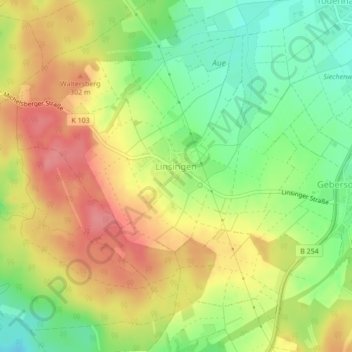
Name: Linsingen topographic map, elevation, terrain.
Location: Linsingen, Frielendorf, Schwalm-Eder-Kreis, Hessen, Deutschland (50.95143 9.25768 50.97040 9.29713)
Average elevation: 280 m
Minimum elevation: 238 m
Maximum elevation: 319 m