Geolocate

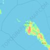
Mabato-bato topographic map

Click on the map to display elevation.

About this map

Name: Mabato-bato topographic map, elevation, terrain.

Location: Mabato-bato, Masbate, Bicol Region, Philippines (12.31325 123.37226 12.35325 123.41226)

Average elevation: 124 m

Minimum elevation: 51 m

Maximum elevation: 246 m

Other topographic maps

Click on a map to view its topography, its elevation and its terrain.

Burias

Philippines > Masbate

Average elevation: 18 m

Ticao Island

Philippines > Masbate

Average elevation: 23 m

San Pascual

Philippines > Masbate

Average elevation: 7 m

Jintotolo Island

Philippines > Masbate > Jintotolo

Its elevation was recorded at around 120 feet (37 m) in 1919. A lighthouse with a tower at 51 feet (16 m) in height exists on Jintotolo island.

Average elevation: 6 m
Sagawsawan River

Philippines > Masbate > Tabuc

Average elevation: 119 m

Ticao Island

Philippines > Masbate

Average elevation: 23 m

Ticao Island

Philippines > Masbate

Average elevation: 23 m

Burias

Philippines > Masbate

Average elevation: 18 m

Manocmanoc Island

Philippines > Masbate

Average elevation: 0 m

Ticao Island

Philippines > Masbate

Average elevation: 23 m

Masbate

Philippines > Masbate

Average elevation: 26 m

Puro Islet

Philippines > Masbate > Pandan

Average elevation: 15 m

Gilotongan

Philippines > Masbate

Average elevation: 0 m

Gear up for your next adventure:

🧭Global Orienteering Compass - High-precision liquid-filled compasses for accurate map reading and navigation
🛠️Outdoor Repair Kits - Gear repair kits
🍳Ultralight Camping Stoves - Boil water quickly for meals using minimal fuel
🧥Packable Rain Jackets - Breathable waterproof layers for unpredictable mountain weather
🔥Windproof Plasma Lighters - USB rechargeable lighters that work in high-altitude winds

As an Amazon Associate, this site earns from qualifying purchases at no extra cost to you.