
Raleigh topographic map
Click on the map to display elevation.
Raleigh
Raleigh is located in the northeast central region of North Carolina, where the Piedmont and Atlantic Coastal Plain regions meet. This area is known as the "fall line" because it marks the elevation inland at which waterfalls begin to appear in creeks and rivers. As a result, most of Raleigh features gently rolling hills that slope eastward toward the state's flat coastal plain. Its central Piedmont location situates Raleigh about two hours west of Atlantic Beach, North Carolina, by car and four hours east of the Great Smoky Mountains. The city is 172 miles (277 km) south of Richmond, Virginia, 278 miles (447 km) south of Washington, D.C., and 167 miles (269 km) northeast of Charlotte, North Carolina. A small portion of the city is located in Durham County.
About this map
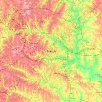
Name: Raleigh topographic map, elevation, terrain.
Average elevation: 103 m
Minimum elevation: 27 m
Maximum elevation: 167 m