Geolocate

Rockport topographic map

Interactive map

Click on the map to display elevation.

Rockport

The topography of Rockport, Texas, is defined by its flat, coastal terrain, with the city's average elevation being around 20 feet above sea level. The land is largely shaped by the proximity to the Gulf of Mexico, which influences the area's low-lying nature, including some areas below sea level. The surrounding region is characterized by shallow waters, estuaries, and salt marshes, providing rich wildlife habitats. This coastal setting contributes to Rockport's scenic beaches and its status as a popular tourist destination, offering views of the water and nearby islands.

About this map

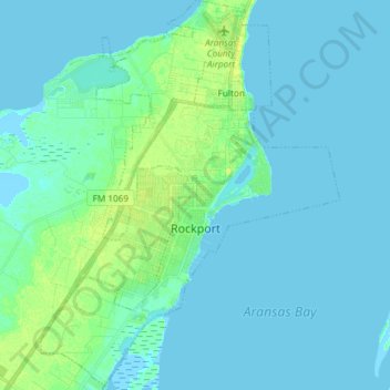
Name: Rockport topographic map, elevation, terrain.

Location: Rockport, Aransas County, Texas, 78382, United States (27.96631 -97.11330 28.09711 -96.99953)

Average elevation: 3 m

Minimum elevation: -2 m

Maximum elevation: 14 m

Other topographic maps

Click on a map to view its topography, its elevation and its terrain.