

Redmond topographic map
Click on the map to display elevation.
Redmond
The city encompasses 15.5 square miles (40 km2) and is on a plateau, at an elevation of 3,077 feet (938 m). Redmond is 15 miles (24 km) north of Bend—the county seat of Deschutes County—144 miles (232 km) from Portland, 129 miles (208 km) from Salem—the capital of Oregon—and 126 miles (203 km) from Eugene.
About this map
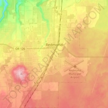
Name: Redmond topographic map, elevation, terrain.
Location: Redmond, Deschutes County, Oregon, 97756, United States (44.22580 -121.23475 44.31077 -121.13355)
Average elevation: 921 m
Minimum elevation: 830 m
Maximum elevation: 987 m