Scottsdale topographic map
Click on the map to display elevation.
Scottsdale
The city is in the Salt River Valley, or the "Valley of the Sun," in the northern reaches of the Sonoran Desert. Scottsdale, 31 mi (50 km) long and 11.4 mi (18.3 km) wide at its widest point, shares boundaries with many other municipalities and entities. On the west, Scottsdale is bordered by Phoenix, Paradise Valley, and unincorporated Maricopa County land. Carefree is along the eastern boundary, as well as sharing Scottsdale's northern boundary with the Tonto National Forest. To the south Scottsdale is bordered by Tempe. The southern boundary is also occupied by the Salt River Pima-Maricopa Indian Community, which extends along the eastern boundary, which also borders Fountain Hills, the McDowell Mountain Regional Park and more unincorporated Maricopa County land. The highest point is Butte Peak at an elevation of 4,890 ft.
About this map
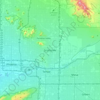
Name: Scottsdale topographic map, elevation, terrain.
Location: Scottsdale, Maricopa County, Arizona, 85251, United States (33.33422 -112.08602 33.65422 -111.76602)
Average elevation: 414 m
Minimum elevation: 306 m
Maximum elevation: 1,193 m
Other topographic maps
Click on a map to view its topography, its elevation and its terrain.