
Thank you for supporting this site ❤️
Make a donation
Make a donation
Gear up for your next adventure:
As an Amazon Associate, this site earns from qualifying purchases at no extra cost to you.
Sabanilla topographic map
Click on the map to display elevation.
Thank you for supporting this site ❤️
Make a donation
Make a donation
Gear up for your next adventure:
As an Amazon Associate, this site earns from qualifying purchases at no extra cost to you.
About this map
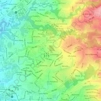
Name: Sabanilla topographic map, elevation, terrain.
Location: Sabanilla, Montes de Oca, San Jose Province, 11502, Costa Rica (9.93420 -84.04402 9.95205 -84.02241)
Average elevation: 1,263 m
Minimum elevation: 1,201 m
Maximum elevation: 1,340 m
Thank you for supporting this site ❤️
Make a donation
Make a donation
Gear up for your next adventure:
As an Amazon Associate, this site earns from qualifying purchases at no extra cost to you.