
Dongollo topographic map
Interactive map
Click on the map to display elevation.
About this map
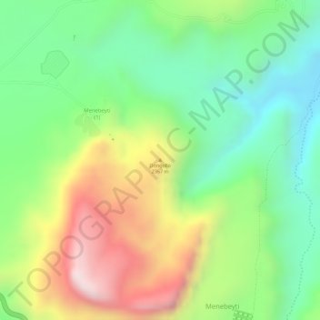
Name: Dongollo topographic map, elevation, terrain.
Location: Dongollo, Fatsi ፋጺ, Eastern Tigray, Tigray, Äthiopien (14.41980 39.38551 14.41990 39.38561)
Average elevation: 2,511 m
Minimum elevation: 2,279 m
Maximum elevation: 2,833 m