
Unkel topographic map
Interactive map
Click on the map to display elevation.
About this map
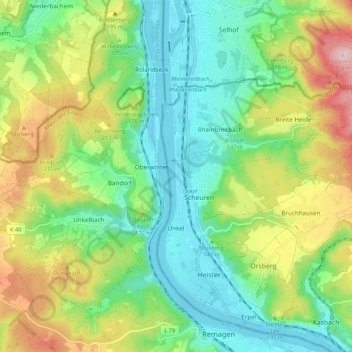
Name: Unkel topographic map, elevation, terrain.
Location: Unkel, Landkreis Neuwied, Rhineland-Palatinate, Germany (50.58362 7.21001 50.63549 7.31667)
Average elevation: 147 m
Minimum elevation: 50 m
Maximum elevation: 330 m
Other topographic maps
Click on a map to view its topography, its elevation and its terrain.