
High Point topographic map
Interactive map
Click on the map to display elevation.
About this map
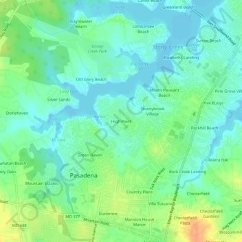
Name: High Point topographic map, elevation, terrain.
Average elevation: 12 m
Minimum elevation: -2 m
Maximum elevation: 36 m
Other topographic maps
Click on a map to view its topography, its elevation and its terrain.
Green Haven
United States > Maryland > Anne Arundel County > Pasadena
Green Haven, Pasadena, Anne Arundel County, Maryland, 21122, United States
Average elevation: 15 m
Powhatan Village
United States > Maryland > Anne Arundel County > Pasadena
Powhatan Village, Pasadena, Anne Arundel County, Maryland, 21060, United States
Average elevation: 19 m
Jacobsville
United States > Maryland > Anne Arundel County > Pasadena
Jacobsville, Pasadena, Anne Arundel County, Maryland, 21122, United States
Average elevation: 18 m