
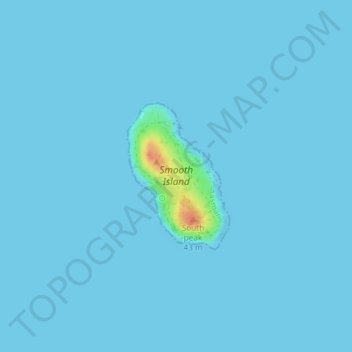
Smooth Island topographic map
Click on the map to display elevation.
About this map
Name: Smooth Island topographic map, elevation, terrain.
Location: Smooth Island, Tasman, Tasmania, Australia (-42.95100 147.77924 -42.93985 147.78987)
Average elevation: 1 m
Minimum elevation: 0 m
Maximum elevation: 41 m
Tasmania trails, hiking, mountain biking, running and outdoor activities
Other topographic maps
Click on a map to view its topography, its elevation and its terrain.