
Urrao topographic map
Interactive map
Click on the map to display elevation.
About this map
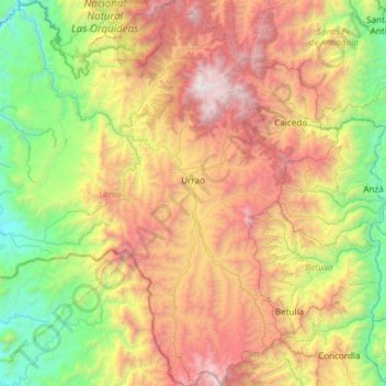
Name: Urrao topographic map, elevation, terrain.
Location: Urrao, Suroeste, Antioquia, Colômbia (5.99763 -76.58209 6.59369 -75.99050)
Average elevation: 1,677 m
Minimum elevation: 235 m
Maximum elevation: 3,933 m