
Errenteria topographic map
Interactive map
Click on the map to display elevation.
About this map
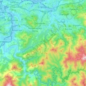
Name: Errenteria topographic map, elevation, terrain.
Location: Errenteria, Guipuscoa, Pays basque autonome, 20100, Espagne (43.20679 -1.93201 43.32188 -1.84870)
Average elevation: 190 m
Minimum elevation: -2 m
Maximum elevation: 781 m