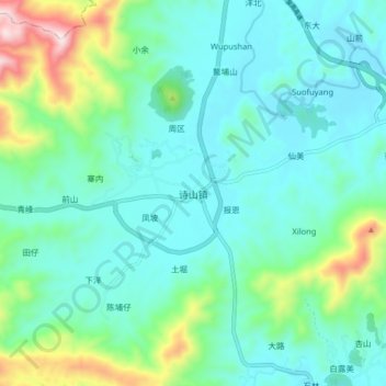
Geolocate

诗山镇 topographic map

Interactive map

Click on the map to display elevation.

About this map

Name: 诗山镇 topographic map, elevation, terrain.

Location: 诗山镇, 南安市, 泉州市, 福建省, 中国 (25.14609 118.24322 25.22609 118.32322)

Average elevation: 193 m

Minimum elevation: 67 m

Maximum elevation: 668 m

Other topographic maps

Click on a map to view its topography, its elevation and its terrain.

丹霞

中国 > 福建省 > 南安市

丹霞, 南安市, 泉州市, 福建省, 中国

Average elevation: 200 m

官桥镇

中国 > 福建省 > 南安市

官桥镇, 南安市, 泉州市, 福建省, 中国

Average elevation: 43 m

云顶山

中国 > 福建省 > 南安市

云顶山, 南安市, 泉州市, 福建省, 中国

Average elevation: 940 m

埕边

中国 > 福建省 > 南安市 > 水头镇

埕边, 水头镇, 南安市, 泉州市, 福建省, 中国

Average elevation: 12 m