Geolocate

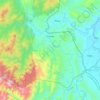
Calanasan topographic map

Click on the map to display elevation.

Calanasan

The town's topography or slope is predominantly rugged and mountainous with sporadic flood plains and plateaus. The municipality cradles the larger part of the Apayao-Abulog watershed area as the main source of streams that fills the mighty river which originates from the municipality.

Wikipedia (CC-BY-SA 3.0)

About this map

Name: Calanasan topographic map, elevation, terrain.

Location: Calanasan, Apayao, Cordillera Administrative Region, 3814, Philippines (18.21511 121.00349 18.29511 121.08349)

Average elevation: 524 m

Minimum elevation: 246 m

Maximum elevation: 1,172 m

Other topographic maps

Click on a map to view its topography, its elevation and its terrain.

Luna

Philippines > Apayao

Average elevation: 86 m

Conner

Philippines > Apayao

Average elevation: 406 m

Abulug River

Philippines > Apayao

Average elevation: 77 m

Pudtol

Philippines > Apayao

Average elevation: 209 m

Apayao River

Philippines > Apayao

Average elevation: 614 m

Apayao River

Philippines > Apayao

Average elevation: 614 m

Abulug River

Philippines > Apayao

Average elevation: 77 m

Gear up for your next adventure:

👄SPF Lip Balm - Prevent sun and wind-burnt lips on mountain ridges
🧴SPF 50+ Bulk Sunscreen - Maximum protection for long-term outdoor exposure
📦Crushproof Equipment Cases - Safe transport for sensitive surveying and mapping instruments
🔋Rechargeable Batteries - Eco-friendly power for high-drain GPS units and flashlights
🧼Biodegradable Soap - Eco-friendly outdoor soap

As an Amazon Associate, this site earns from qualifying purchases at no extra cost to you.