
合肥蜀山经济技术开发区 topographic map
Interactive map
Click on the map to display elevation.
About this map
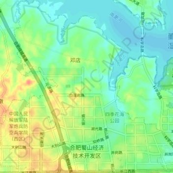
Name: 合肥蜀山经济技术开发区 topographic map, elevation, terrain.
Location: 合肥蜀山经济技术开发区, 蜀山区, 安徽省, 中国 (31.85270 117.11895 31.90567 117.17854)
Average elevation: 39 m
Minimum elevation: 24 m
Maximum elevation: 65 m
Other topographic maps
Click on a map to view its topography, its elevation and its terrain.