
Meuzegem topographic map
Interactive map
Click on the map to display elevation.
About this map
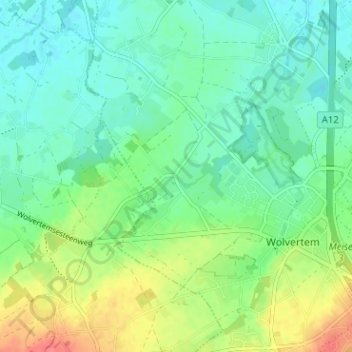
Name: Meuzegem topographic map, elevation, terrain.
Average elevation: 30 m
Minimum elevation: 11 m
Maximum elevation: 70 m
Other topographic maps
Click on a map to view its topography, its elevation and its terrain.
Rossem
België > Vlaams-Brabant > Halle-Vilvoorde > Meise > Wolvertem
Rossem, Wolvertem, Meise, Halle-Vilvoorde, Vlaams-Brabant, Vlaanderen, 1840, België
Average elevation: 19 m