
Kerobokan Klod topographic map
Interactive map
Click on the map to display elevation.
About this map
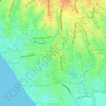
Name: Kerobokan Klod topographic map, elevation, terrain.
Location: Kerobokan Klod, Badung, Bali, 08361, Indonesia (-8.69165 115.14401 -8.65165 115.18401)
Average elevation: 16 m
Minimum elevation: 0 m
Maximum elevation: 40 m
Other topographic maps
Click on a map to view its topography, its elevation and its terrain.