
Шубаркудук topographic map
Interactive map
Click on the map to display elevation.
About this map
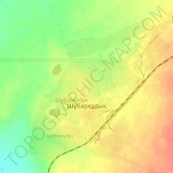
Name: Шубаркудук topographic map, elevation, terrain.
Location: Шубаркудук, Темирский район, Актюбинская область, Казахстан (49.12834 56.45908 49.16669 56.52048)
Average elevation: 187 m
Minimum elevation: 162 m
Maximum elevation: 207 m
Other topographic maps
Click on a map to view its topography, its elevation and its terrain.
Шубаркудук
Казахстан > Актюбинская область > Темирский район > Шубаркудук
Шубаркудук, Темирский район, Актюбинская область, Казахстан
Average elevation: 185 m